by Rehana Thomas & Karina Salimbayeva | April 30, 2026
In many discussions across the carbon market, the term digital MRV (DMRV) is used to describe the digitalization of carbon registries, reporting workflows, and project documentation systems. While these developments are important for improving transparency and efficiency, they represent only one aspect of how digital technologies are transforming carbon markets.
In the context of nature-based carbon projects, digital MRV more commonly refers to the integration of remote sensing, geospatial analytics, and digital data workflows into the monitoring of ecosystems themselves. Rather than simply digitalizing reporting processes, these tools enable new ways of observing land-use change, estimating biomass, and monitoring project performance across large landscapes.
Traditional MRV in Nature-Based Projects
In nature-based carbon projects, credibility starts with MRV (Monitoring, Reporting, and Verification). MRV refers to the system used to measure and monitor ecosystem changes, report the resulting emissions reductions or carbon removals, and independently verify those outcomes against approved methodologies. At its core, MRV is what allows carbon markets to function with confidence. By providing a transparent and structured way to track climate benefits over time, MRV creates the evidence base that underpins carbon credit issuance and the integrity of climate claims.
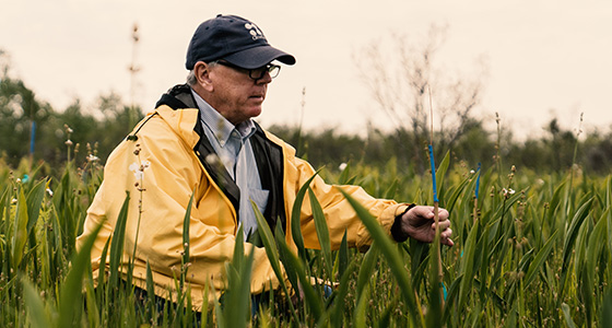
Traditionally, MRV in nature-based projects has been grounded in field-based monitoring and statistically designed sampling approaches. This model underpins a wide range of project types, including Improved Forest Management (IFM ), Afforestation, Reforestation and Revegetation (ARR), mangrove restoration, and other ecosystem-based carbon initiatives.
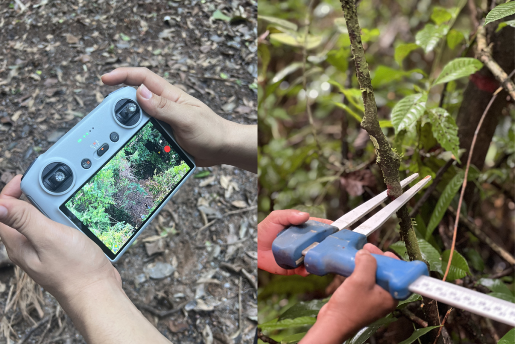
Field-based monitoring typically relies on statistically distributed plots across the project area, where attributes such as Diameter at Breast Height (DBH), height, and species are recorded. These measurements are used with biomass equations to estimate carbon stocks. In some project types, including afforestation/restoration/reforestation (ARR), monitoring may also include soil carbon measurements. Field-based monitoring provides the empirical foundation for determining the impacts of project activities on carbon stocks and understanding how they change over time. As ecosystems regenerate, develop, and/or experience disturbances, periodic remeasurement of monitoring plots allows project developers to quantify changes in carbon stocks during each monitoring period.
These monitoring results are then compiled into structured reports submitted to carbon registries and undergo independent third-party verification, where auditors assess whether the project’s monitoring approach and reported outcomes comply with the requirements of the applicable carbon methodology.
Because it relies on direct observation, traditional MRV has long been considered a scientifically rigorous approach to carbon accounting. As nature-based carbon projects expand in scale and geographic diversity, the industry has increasingly begun exploring how digital technologies can complement these traditional monitoring systems.
What Makes MRV “Digital”?
Digital MRV refers to the integration of remote sensing technologies, automated data processing, and digital platforms into traditional monitoring systems. In practice, this often includes the use of cloud-based geospatial processing environments and standardized data pipelines to handle large volumes of spatial data.
Instead of relying solely on periodic field measurements, DMRV incorporates technologies such as:
- Satellite imagery (e.g., Landsat, Sentinel, Planet) to track land cover change, vegetation indices (e.g., NDVI), and forest condition over time
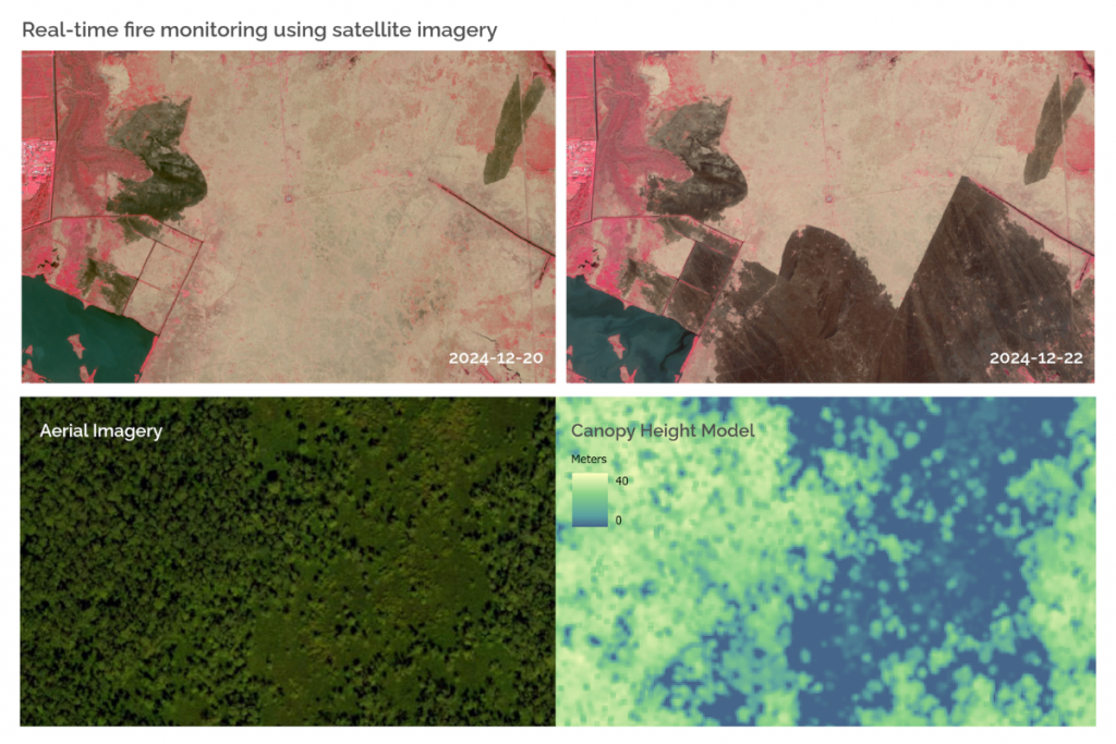
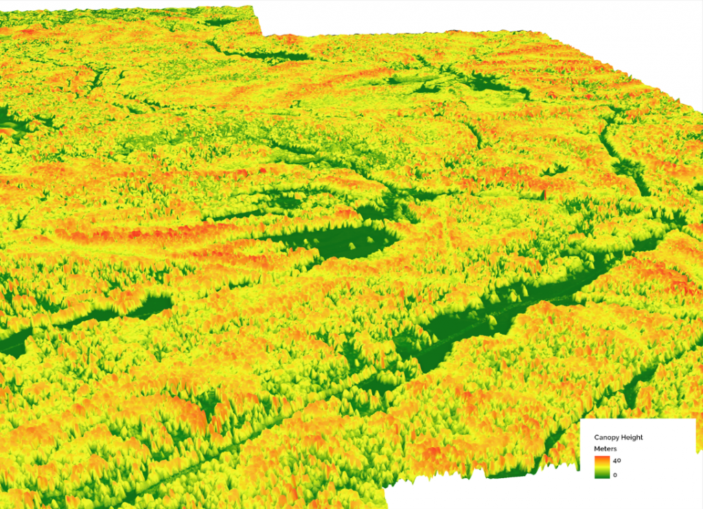
- LiDAR and radar (SAR) data to estimate forest structure (e.g., canopy height, vertical profiles) and improve aboveground biomass estimates, including in persistently cloudy regions
- Machine learning models trained on field plot data to analyze patterns in remote sensing data and predict changes in carbon stocks across entire project areas
- Digital platforms and dashboards (e.g., GIS-based tools) to visualize spatial outputs, manage datasets, and support traceability and auditability of results
These tools allow project developers to monitor forests and landscapes more frequently and across larger geographic areas than would be possible through field surveys alone, often at spatial resolutions of 10–30 meters and on monthly or annual time steps.
For example, remote sensing can be used to detect disturbances such as harvesting, fire, and/or land conversion across an entire project area using time-series change detection methods. This type of analysis enables project teams to confirm whether disturbance events have had a material impact on forest carbon stocks and ultimately on credit issuance.
Rather than replacing traditional MRV, digital tools are increasingly being used to enhance monitoring systems, improve consistency and scalability, and provide additional layers of spatially explicit information.
Why Digital MRV Is Gaining Attention?
Interest in digital MRV has accelerated in recent years because of several potential advantages for carbon projects, particularly as projects scale and expectations around transparency and data quality increase.
Lower Monitoring Costs
Maintaining extensive field plot networks and conducting site visits can represent a significant portion of project monitoring costs. Digital tools can reduce the frequency of certain field activities by enabling remote monitoring and more targeted field campaigns. This reduces the need for field crews to travel to remote areas, lowers operational costs, and can improve safety while still maintaining data quality through model calibration approaches.
More Frequent Monitoring
Satellite imagery and remote sensing datasets are collected on regular revisit cycles (e.g., daily to monthly), enabling near real-time observation of landscapes. This makes it possible to detect disturbances or land-use changes much faster than traditional monitoring cycles, which are often conducted every several years. More frequent monitoring also supports earlier intervention and more responsive project management.
Improved Transparency
Digital monitoring can generate continuous, spatially explicit data streams and visual evidence of project performance. Interactive maps, dashboards, and spatial data platforms make it easier for stakeholders, including auditors, registries and credit buyers, to access, interpret, and validate project data. In some cases, this also supports more standardized and reproducible monitoring workflows.
Scalability
Nature-based solutions are often implemented across large or remote landscapes where field access is limited. Digital monitoring enables consistent, wall-to-wall observation across entire project areas and can be extended to regional or national scales. This supports the expansion of carbon programs and jurisdictional approaches without a proportional increase in field-based monitoring effort.
Together, these advantages have made digital MRV an increasingly important topic for carbon registries, project developers, and investors, particularly as the market moves toward higher expectations for data transparency, consistency, and scalability.
Why Fiel Data Still Matters
Despite rapid advances in remote sensing and digital monitoring tools, digital MRV does not eliminate the need for field-based data. Many digital approaches estimate biomass or carbon stocks using indicators derived from satellite imagery, LiDAR, or other remote sensing datasets. These indicators are used in predictive models that must be calibrated and validated using measurements collected in field plots to produce reliable carbon estimates.
Field monitoring also captures ecological details that are difficult to detect remotely, such as species composition, vegetation condition, and other structural characteristics of ecosystems. These observations remain important for understanding ecosystem dynamics, particularly in restoration projects such as afforestation, reforestation, and mangrove restoration.
For this reason, digital MRV is best viewed as a complement to traditional monitoring rather than a replacement. Field plots provide the empirical foundation for carbon accounting, while digital tools extend the ability to monitor landscapes more frequently and at larger scales.
Methodology Evolution and the Future of MRV
As monitoring technologies evolve, carbon methodologies are beginning to incorporate digital tools more explicitly. Some methodologies already rely on remote sensing data to support key components of carbon accounting. For example, certain methodologies use satellite-derived metrics to estimate forest stocking and develop dynamic baselines by comparing project areas with similar control landscapes.
A notable example is Verra’s VM0047 methodology, which implements a performance benchmarking framework that uses remote sensing metrics to evaluate project performance relative to control areas that are statistically matched based on historical biomass trajectories. More broadly, these developments reflect a shift toward remote sensing-driven and data-intensive approaches to carbon monitoring and crediting, where digital tools are used not only to improve efficiency but also to strengthen the scientific robustness and credibility of projects.
Registries and standards bodies are also actively exploring how digital monitoring can improve the efficiency, transparency, and scalability of carbon projects while maintaining scientific rigor. At the same time, elements of reporting and verification are beginning to incorporate digital systems, including standardized data platforms and improved access to project data for auditors.
Carbon markets are also placing increasing emphasis on credit quality. High-quality projects are expected to demonstrate robust monitoring systems, transparent data, and credible verification processes. Digital MRV has the potential to strengthen these systems by providing better data coverage, faster insights, and more transparent reporting, but only when implemented alongside strong scientific and methodological foundations.
About the Authors
Rehana Thomas is a Nature Based Technical Specialist at ClimeCo. Her work focuses on the development and implementation of nature-based carbon projects, combining geospatial analysis, remote sensing, and carbon accounting methodologies to support high-quality climate solutions. Rehana is particularly interested in how digital tools and data can improve the monitoring, reporting, and verification of ecosystem-based carbon projects and inform better decision-making for climate and conservation outcomes.
Karina Salimbayeva is a Nature Based Technical Specialist at ClimeCo, whose work focuses on using geospatial analysis and data-driven approaches to support the development and performance of carbon projects. With a background in ecology, she works with spatial data to better understand landscape dynamics and translate those insights into practical approaches for carbon accounting and project implementation. She is particularly interested in making digital tools and data more accessible, helping bridge the gap between complex analysis and real-world decision-making.